The Area Surrounding Ave Maria Florida

The areas north, south and east of Ave Maria are agricultural lands. Row crops are grown on the north and south ag-lands, and orange groves on the east side of Camp Keais Road. Camp Keais was one of many forts built during the Seminole wars in the 1830s and was located south of Lake Trafford, just north of Ave Maria.

The land directly across the NE side of town is owned by Barron Collier Companies. These 993 acres are the next planned addition to the town of Ave Maria FL.

West of Ave Maria FL on Oil Well Rd

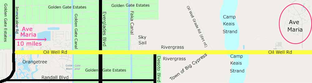
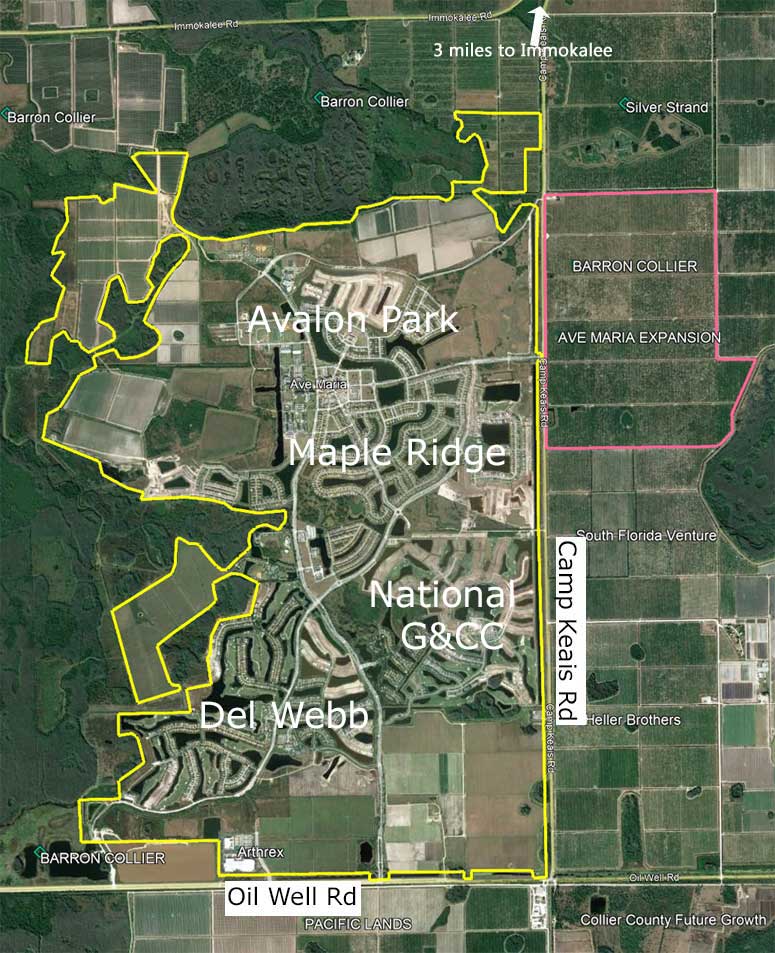
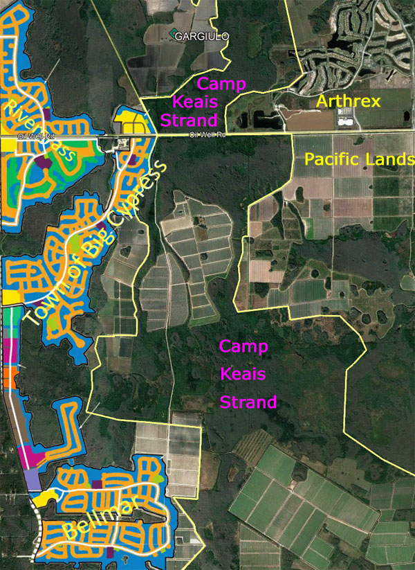
Oil Well Road was named for the first oil well field in Florida, located just a few miles east of Ave Maria. Heading west on Oil Well Rd from Ave Maria, on the south side are the Pacific Lands' tomatoes fields, on the north is the Arthrex medical device manufacturing facility.

The wooded area first seen on the south side of Oil Well is part of the Camp Keais Strand. To the north, before reaching the wooded area, are Barron Collier lands.

Oil Well Rd then crosses the Camp Keais Strand. This area has three separate bridges for water flow and wildlife crossings. The Camp Keais Strand stretches from Lake Trafford, 8 miles to the north from this point, down to the Fakahatchee Preserve, south of I75.

West of the Camp Keais Strand, Oil Well Rd passes by ag-lands. These ag-lands were approved in 2023 for the development of the Town of Big Cypress, the Village of Rivergrass and the Village of Bellmar. Like Ave Maria, they were approved as part of the Rural Lands Stewardship Area's growth management plan.

This development is a Collier Enterprises venture. The Town of Big Cypress and the Village of Rivergrass are planned to be the first communities to begin building for this venture. In total there are 8,000 homes planned.

The Village of Rivergrass, like the National Golf and Country Club at Ave Maria, will be a bundled golf community. As with the National, all owners will be members to the club, but a limited number of members will have golf privileges.

Oil Well Rd West of Desoto

Just west of the Collier Enterprises ag-lands, there is the turn for Desoto Blvd on the south side of Oil Well. Desoto is at the very eastern edge of Golden Gate Estates. GGEs had been billed as the world's largest subdivision. GGEs was created in the 1960s by draining swamplands through a series of canals. These canals funneled water from the area directly to the Gulf of Mexico. This drainage project created great environmental damage to the wetlands south of I-75.

GGEs northern boundary is 5 miles north of this point, and its southern boundary is 10 miles away, ending at Alligator Alley. The original boundary of GGEs extended south of I75, but that area has since been reclaimed and restored for environmental reasons.

On the north side of Oil Well is the community of Skysail. This 246-acre community has many lakes for motorless watercraft - sailing, canoeing and kayaking.

At the western boundary of Skysail, Oil Well Rd crosses the Faka Canal. This canal until recently, drained water directly into the Gulf of Mexico. The Faka canal has now been filled, south of I75, allowing water to take a more natural route to the Gulf.

Orangetree Area

Golden Gate Canal marks the eastern border of the Orangetree area. The water flow from this canal has a 22-mile journey to the the Naples Bay.

The Orangetree community was the first planned unit development in this area from over 30 years ago and Waterways of Naples, at the NE corner of Oil Well and Immokalee, began in the mid 1990s.

New Homes can be purchased at Orange Blossom Ranch (Lennar), Orange Blossom Groves (Lennar) and Terreno (Divosta). The Valencia Golf Course is corporately owned and is currently not connected to any development.

On the west side of Immokalee Rd, the shops and apartments at "Randall at Orange Tree" are being built. There will be an Aldi, 7-Eleven, McDonalds, self-storage, carwash and other restaurants located there.
Ave Maria FL is 11-miles east from this point.
Experienced Naples Area Real Estate Agent
(C) 2024 Tom Doyle